Asuncion Island (Asuncion Island)
From a European perspective Asuncion was discovered in 1669 by the Spanish missionary Diego Luis de San Vitores who gave it its present name (Assumption of Mary in Spanish). It is likely that it was previously visited in 1522 by the Spanish sailor Gonzalo de Vigo, deserter from the Magellan expedition in 1521, and also the first European castaway in the history of the Pacific. In 1695, the native Chamorros were forcibly removed to Saipan, and three years later to Guam.
Asuncion was ceded by Spain to Germany through the German–Spanish Treaty (1899), toghether with the rest of the Mariana Islands (except Guam). The formalities of cession were carried on November 17, 1899, in Saipan, for all the Northern Mariana Islands.
Following the sale of the Northern Marianas by Spain to the German Empire in 1899, Asuncion was administered as part of German New Guinea. In 1903, the island was leased to a Japanese company, who hunted birds for feathers for export to Japan, and from there to Paris. Six Japanese hunters died on the island in 1910 from illness.
During World War I, Asuncion came under the control of the Empire of Japan and was subsequently administered as the South Seas Mandate. Following World War II, the island came under the control of the United States and was administered as part of the Trust Territory of the Pacific Islands. Since 1978, the island has been part of the Northern Islands Municipality of the Commonwealth of the Northern Mariana Islands.
In 1985, per the Constitution of the Commonwealth of the Northern Mariana Islands, the island was designated as a wilderness area for the protection and conservation of natural resources. Since 2009, the island has been part of Marianas Trench Marine National Monument of the United States.
Map - Asuncion Island (Asuncion Island)
Map
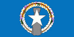
Country - Northern_Mariana_Islands
 |
 |
The United States Department of the Interior cites a landmass of 183.5 sqmi. According to the 2020 United States Census, 47,329 people were living in the CNMI at that time. The vast majority of the population resides on Saipan, Tinian, and Rota. The other islands of the Northern Marianas are sparsely inhabited; the most notable among these is Pagan, which for various reasons over the centuries has experienced major population flux, but formerly had residents numbering in the thousands.
Currency / Language
| ISO | Currency | Symbol | Significant figures |
|---|---|---|---|
| USD | United States dollar | $ | 2 |
| ISO | Language |
|---|---|
| CH | Chamorro language |
| ZH | Chinese language |
| EN | English language |
| TL | Tagalog language |


